|
|
||||||||||||||||||||||||||||||||
|
Image Manager: This extra tool is used to help you decide if areas are a potential risk of data gaps or not. If we using an image sensor it will also calculate the amount of images taken during the mission. 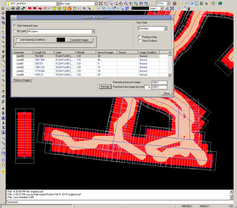  Map Manager: Map manager is supporting a range of file extensions (bmp, jpeg, tif, tiff, gis, lan, bil, bip, bsq, sun, ras, rs, rlc) Useful selecting tool is selecting maps by raster. Simply select the folder with your world maps, ask for raster view. EarthScen will display all containing maps by showing the image boundary, by clicking in a raster you add the map to your map manager. 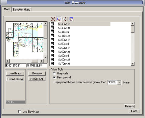 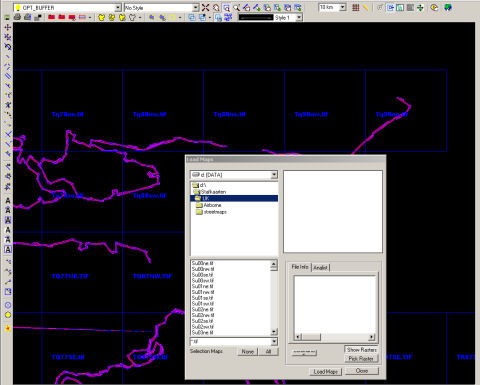 Area Manager: Area manager to maintain your areas. Export options for single area to shape files, and export surface list to excel. 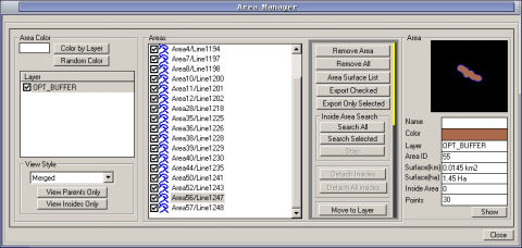 top |
|
||||||||||||||||||||||||||||||||
|
Copyright 2002-2007
© EarthScen. All rights reserved. This application and web page has been a part of a learning project without commercial purpose. |
|||||||||||||||||||||||||||||||||