Reference Files
Reference
files displays as though they were in the active Corridor mode. Although
you cannot
manipulate the
elements,
you can select by attributes
and insert them partly or complete into the active Project.
Supported are DXF,DGN,DWG and SHP files.
The most common usage of reference files is when you want to verify a
new external revision or to
insert extra parts.
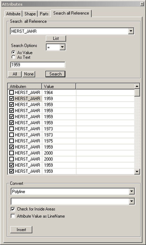
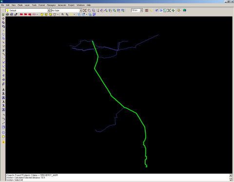
In this example we only insert all lines from a shape file with
attribute 'HERST_JAHR' from 1959.
The green line illustration is the inserted part from the
reference file.
top
Export Files
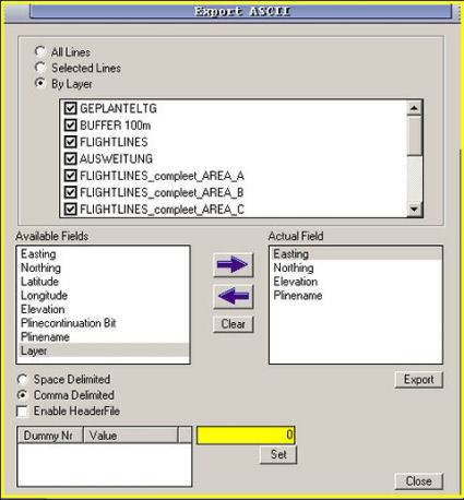
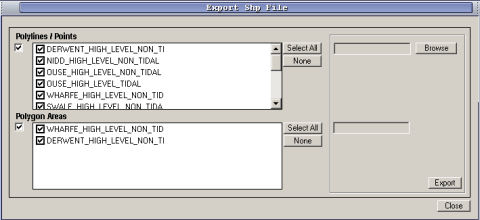
-Any line selection can be exported as an
ASCII file with there own available attributes.
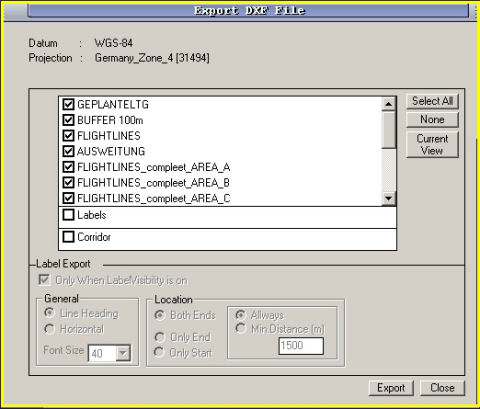
-Dxf export with an extra option for
label and corridor layers.
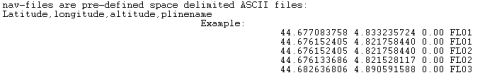
-Nav file export as predefined
ASCII files space delimited.
containing : latitude, longitude,altitude,plinename as show in this
example.
-ESRI shape export by layer.
top
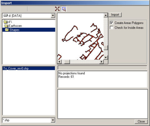
Import
Files
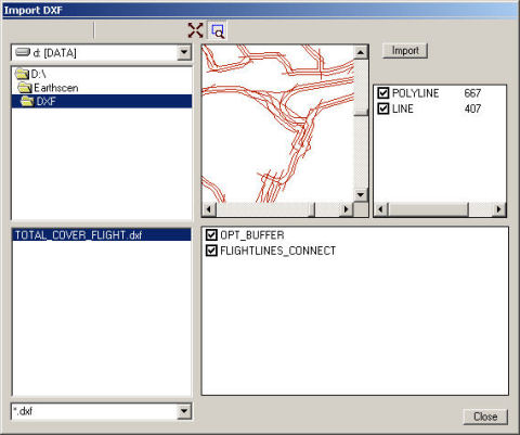
-Dxf (special)
import is different: in this window we can select by element (points,
arc, line, pline),
or exclude layers.
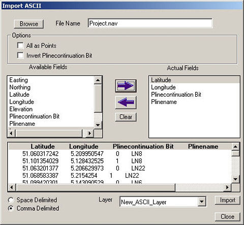
-ASCII import.
Available fields: Easting,northing, latitude,
longitude, elevation,
Plinecontinuation
Bit,Plinename,Layer.
Optional is inverting the Plinecontinuation
Bit and import the complete file as single points.
-General window for
complete file import,
supporting DXF,DGN,DWG and SHP extensions.
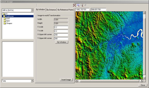
-Non
Georeferenced Images
top
|