|
|
||||||||||||||||||||||||||||||||
|
Generate Tool: This generating tool will create parallel flightlines for simple or complex to cover areas. It works in three steps. step1: First we have to create areas, those are necessary to give the tool a working area. We can create areas by selecting closed Plines, open 'create area form', and push button 'create'. 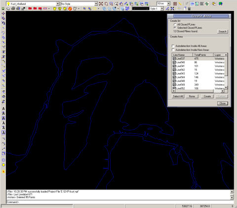 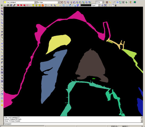 step2: Next step is to create Specified Areas Open the 'Specified Area Manager' and draw a polygon area around your area of interest. 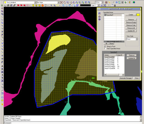 After drawing a list is created with all areas inside the polygon, in this case we are not interested in the last four areas, so we remove them from the list. 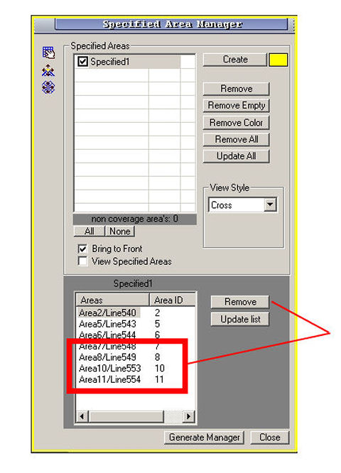 step3: Close the 'Specified area manager' and open the 'Generate manager form', select specified1 and as we can see specified1 contains only three areas (red rectangle). 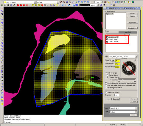 We already created a corridor style in the 'Sensor manager' named Cor1_PHO_AGL309_CW252. A corridor with main image sensor Imperx IPX-11M5, altitude 309 meter and Line spacing 252 meter. Default parallel offset is set to 252 meter and line extension 150 meter. If 'Full rotate' option is set to true, the generate tool will rotate between 0 and 180 degrees and calculate the best heading, regarding distance and lowest line amount. In this case the heading is fixed to 177 degrees. 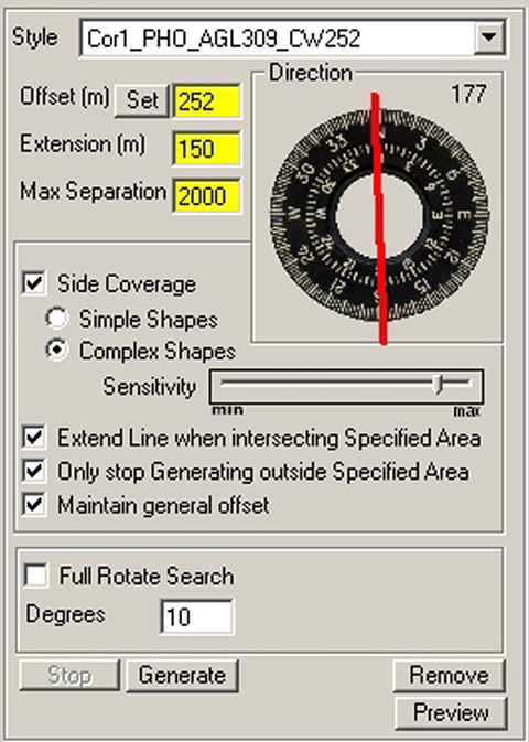 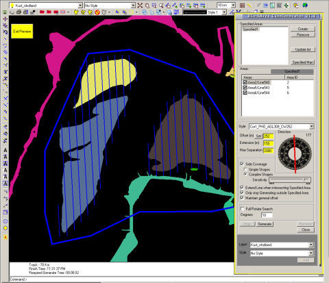 After generating we select a layer to add the attached flightlines. The most work is done, but still there are some areas that need attention. Especially areas where probable data gaps could arise needs an extra parallel line or small adjustment, mostly those are on the edges. Reminding that the most corridors we are working with are 'line spacing corridors'. In the Image manager we can generate uncorrected images to check the risk of data gaps. 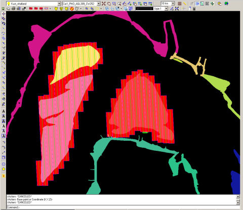 Display after using 'Image manager' 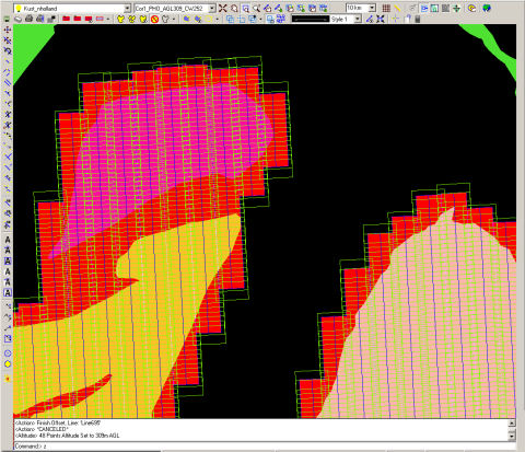 In this area we have a potential gap, by extending Line684 we simply eliminate this risk. Apply those adjustments over the whole area and work is done. 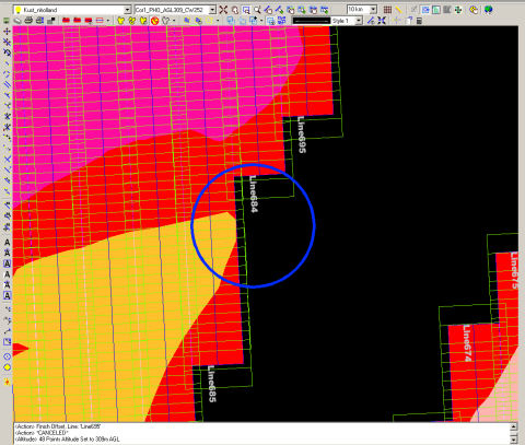 top |
|
||||||||||||||||||||||||||||||||
|
Copyright 2002-2007 ©
EarthScen. All rights reserved. This application and web page has been a part of a learning project without commercial purpose. |
|||||||||||||||||||||||||||||||||